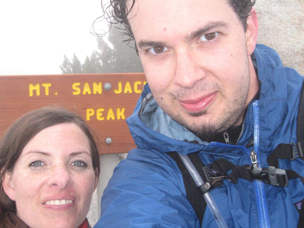
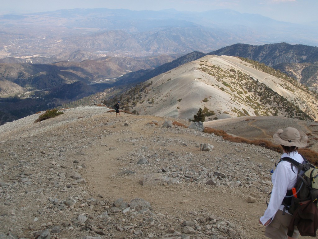
Last Saturday Penelope and I hiked to the top of Mt. San Jacinto via Deer Springs Trail. It was our most challenging hike so far, covering nearly 20 miles with 5,200 feet of elevation gain.
San Jacinto is the third tallest mountain in Southern California. If you've ever driven out to Palm Springs, it's that giant mountain that seems to explode out of the desert to the south of the 10 freeway.
There are several routes to the peak, one of which is to ride the tram and then take a reasonably short hike up from there. A much longer route is called cactus to clouds and is about 23 miles up with over 10,000 feet of elevation gain. We chose the next hardest route, up Deer Springs trail.
The Deer Springs trailhead is located less than a mile from Idyllwild. We pulled in to Idyllwild a bit later than we had intended and secured our permit. We hit the trail at 9:30 a.m. and started our way up.
The first seven miles were very gentle, gaining roughly 500 feet of elevation per mile. The scenery was beautiful with changing leaves in hues of gold and orange and lovely views down the mountain. The weather was perfect, nice and cool with a gentle breeze.
We averaged two miles per hour on the way up. For the last few miles we felt great. The seventh mile was the hardest, we gained about 1,000 feet in one mile, but even that wasn't very difficult.
We reached the summit of Mt. San Jacinto at 2:30 p.m. and ate lunch. The view from the top is spectacular especially on a clear day. We took a few photos and then headed down.
We chose a different and slightly longer route for our descent. We passed through several verdant cienegas. Cienegas are basically swamps, but beautiful and in the mountains. The three was hiked through were lush with foliage and water flowing through their muddy banks.
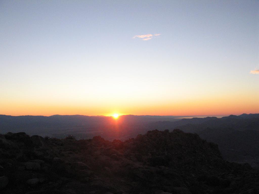
Our route down took longer than we originally estimated and the sun set while we were a couple miles from the trailhead. Being a former Boy Scout I am always (over) prepared and of course we brought our headlamps just in case.
For some odd reason, those last two miles seemed a lot longer than they did nine hours earlier! We ended up back at the car right around 6:30 p.m.
The Deer Springs trail is a wonderful route up to San Jacinto. It was great training for our upcoming cactus to clouds hike. We look forward to doing it again soon.
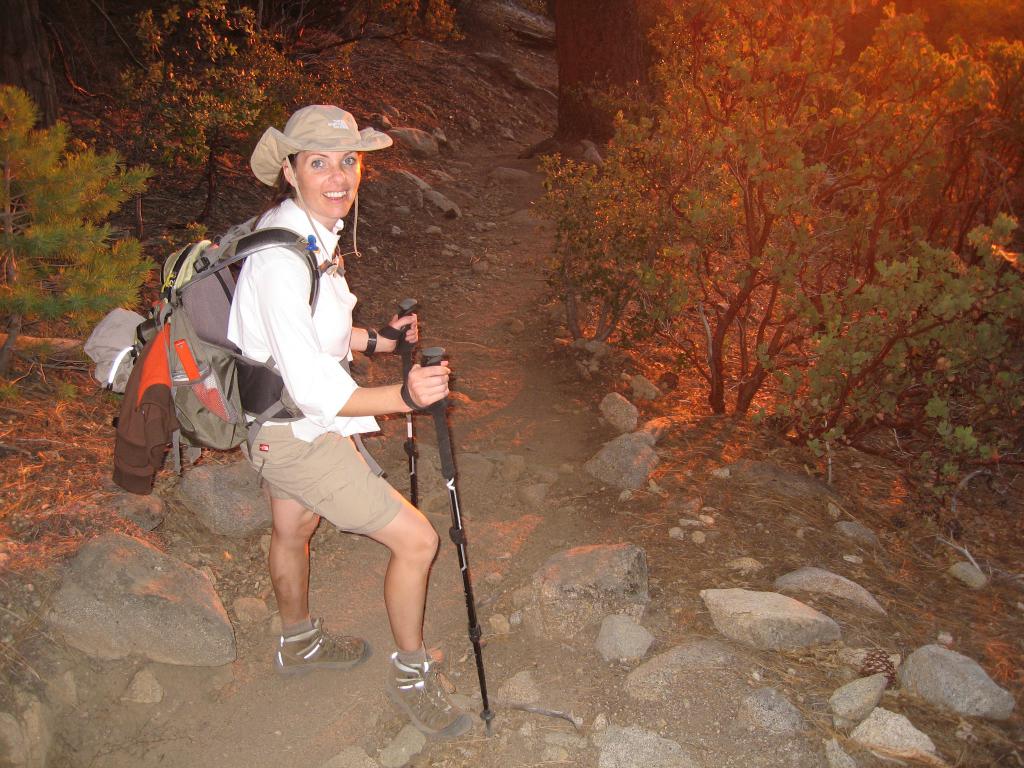
The setting sun casts a red glow on the ground behind Penelope during our hike down from San Jacinto.
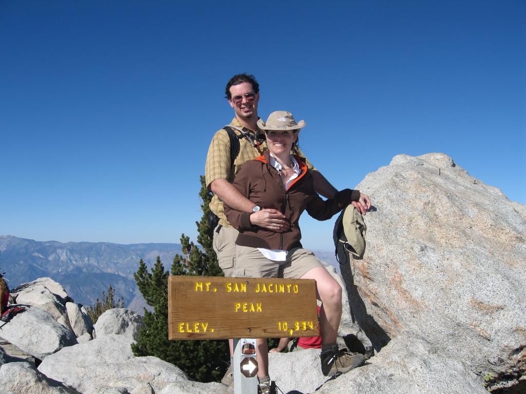
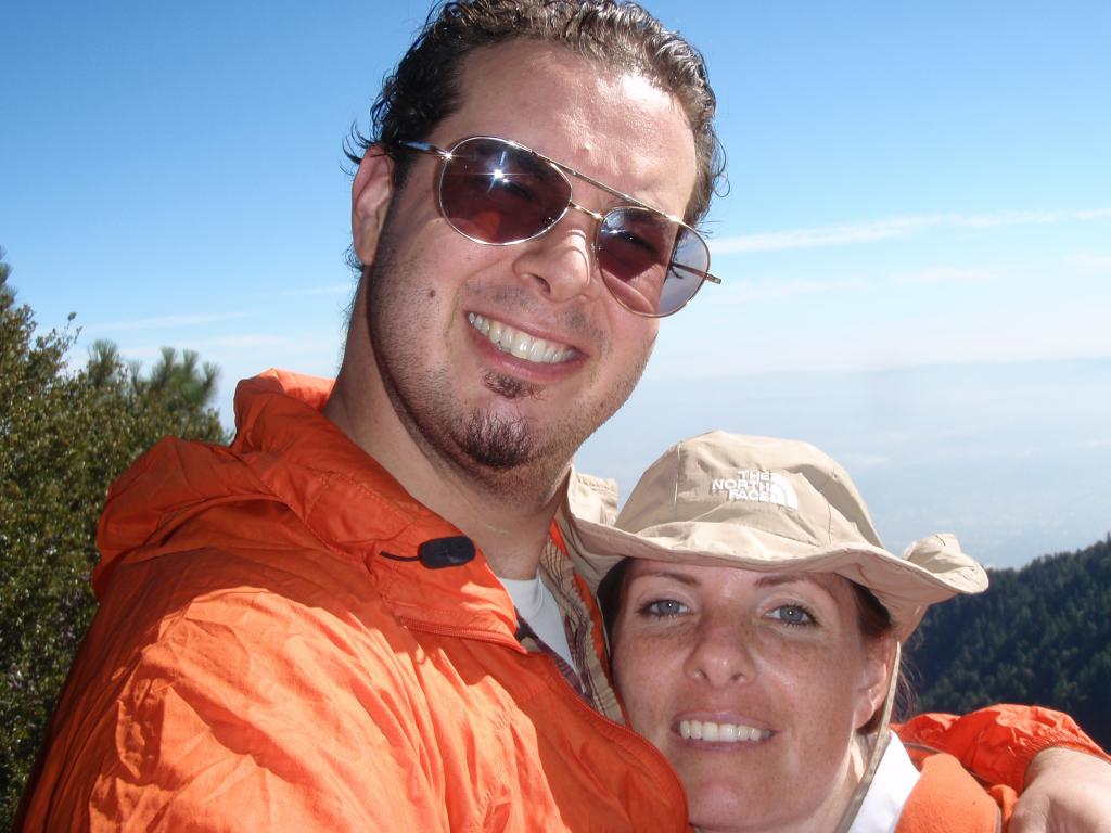
Dave and Penelope pose for a photo after reaching the peak of Mt. San Jacinto.
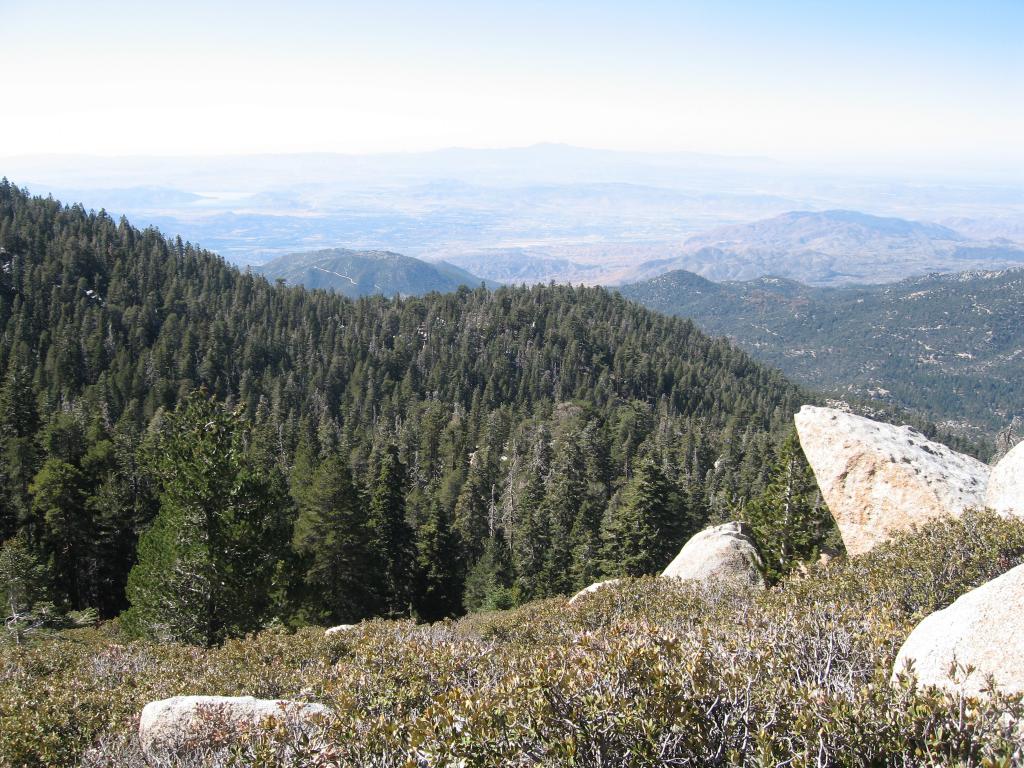
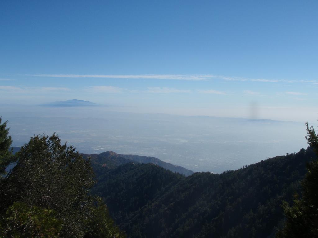
The view is beautiful from halfway up the Deer Springs trail.
Click here to see more photos from our San Jacinto hike.
Monday, October 27th, 2008 -
Read more...
On Saturday Penelope and I took a short hike to Eagle Rock in Topanga Canyon. After a few weeks off following our Cactus to Clouds trek and we were eager to get back to it.
We weren't sure which hike to do, we had originally talked about hiking Mt. Baldy again, but we opted for something closer to home. When Penelope said Eagle Rock, I thought she meant the Eagle Rock suburb near Glendale. Apparently the Eagle Rock she was talking about was an actual rock in Topanga Canyon.
We drove up PCH to Topanga Canyon road, paid our $8 state park fee and started out hike. We laughed at the easy specs of the hike, 7 miles and 800 feet of elevation gain, nothing compared to the 24 miles and 10,000 feet of gain we hiked a few weeks back.
Once we were getting close to Eagle Rock, about 2 miles in, we weren't laughing anymore. Penelope was feeling under the weather and the simple hike became highly unpleasant for her. We were also running short on time due to a meeting I had scheduled.
We opted to turn around at Eagle Rock and head back to the car. We ended up doing a little over four miles, but it was still great to get out into the hills and away from the city.
This time around I brought a good camera and tripod and took some photos of the beautiful views and the beautiful wife.
I'm sure at some point we'll do this hike again and complete it. In the interim we're looking forward to some snow so we can break out the snowshoes. Now that will be fun!
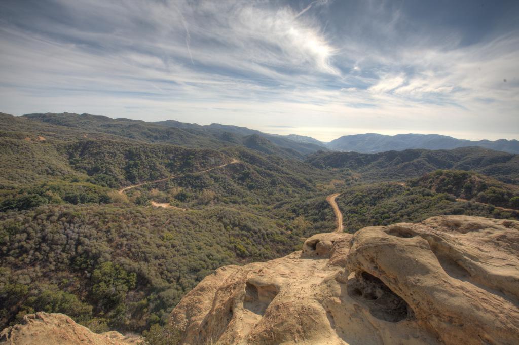
The view from Eagle Rock in Topanga Canyon is beautiful as seen in this composite HDR photo taken on Saturday.
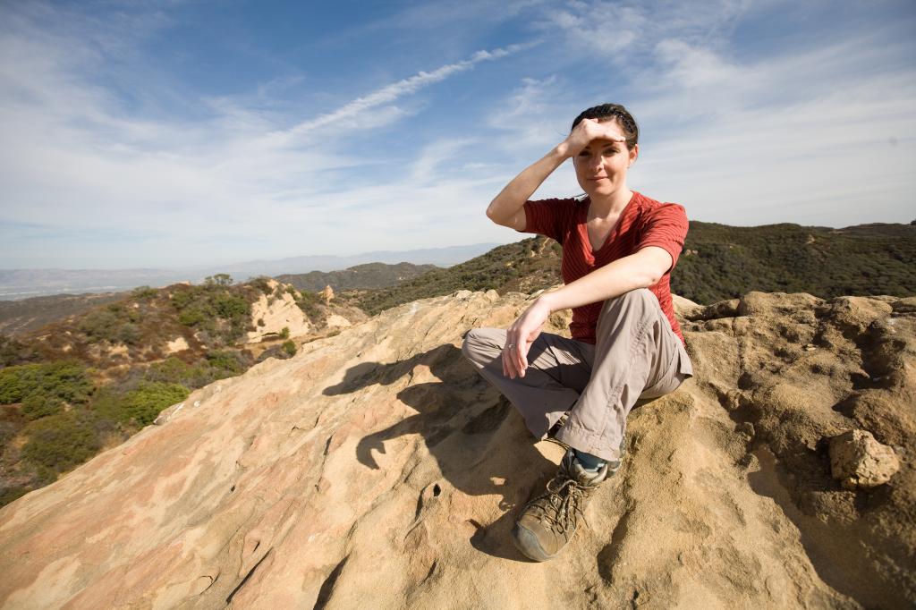
The illustrious and beautiful Penelope Bullock shades her eyes from the sun after a short hike to Eagle Rock in Topanga Canyon.
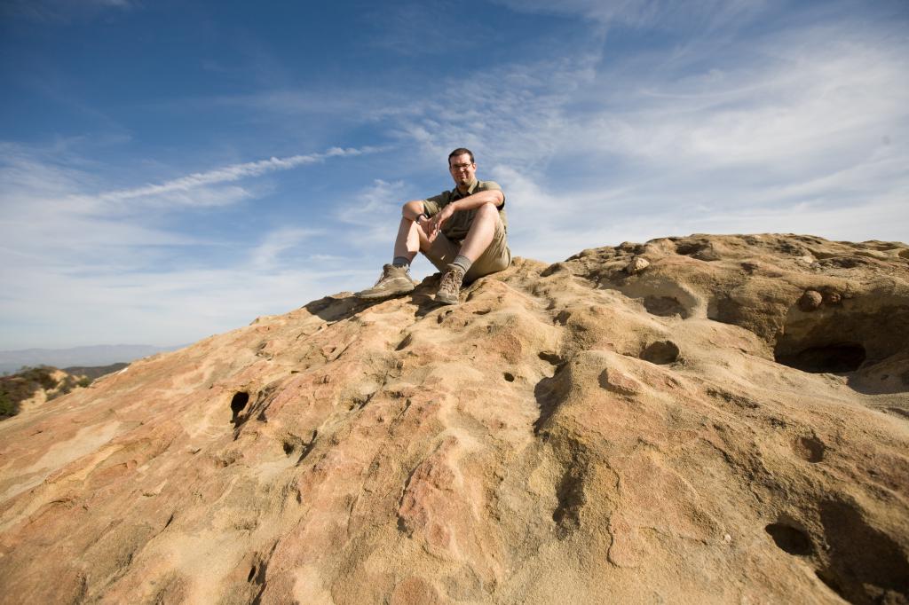
That's me, Dave Bullock, sitting atop Eagle Rock after a short hike on Saturday.
Click here to see the rest of the Eagle Rock photos.
Monday, November 24th, 2008 -
Read more...
This weekend my wonderful, beautiful backpacking wife Penelope and I hiked to the peak of the tallest mountain in Southern California: San Gorgonio.
We have been training every weekend for this backpacking trip by taking nice long day hikes. The difference between our day hikes and the San Gorgonio summit was its 24 mile length compared to the 6 mile trips and of course the fact that we were carrying heavy packs.
We started out early Friday morning and drove up the 38 and then seven miles on a dirt road. This road took us to the Fish Creek trailhead where we parked and started our ascent.
The trail was beautiful and green with a nice gentle climb of about 1,800 feet in six miles. We didn't see another person the whole day we were hiking. Fish Creek trail is definitely less crowded than the other routes to the top.
Once we got to Mine Shaft Saddle we headed down to our campsite at Mine Shaft Flat about a mile and 600 vertical feet downhill. We set up camp and cooked up some dinner, which was quite good despite consisting of various types of ramen noodles and a package of spicy salmon.
The next morning we headed about a half-mile down the trail towards Big Tree camp to fill our water bottles. The water was flowing nicely and was icy cold and fresh. We filled up our containers and then used an MSR MIOX to purify the water.
What I failed to notice was that the test strips which detect the level of chlorine ions made by the MIOX were expired by two years. This caused us to keep adding the MIOX solution and our water tasted like it was fresh from a pool. It ended up being ok to drink, but not the most pleasant experience. Better than being dehydrated or getting Giardia!
The next morning we ate breakfast, broke down camp and headed up to the trailhead where Fish Creek trail intersects with the trail to the summit: Sky High View trail. Once at the intersection we unloaded our packs and stashed our gear, bringing only food, water, first aid and emergency supplies, my ham radio and the SPOT messenger.
The SPOT was nice to have, it allowed us to send our family our position throughout our trip. If there was an emergency we could have also used it to ask for help of request a rescue.
Once we had unloaded our packs, the four and a half mile 3,500' elevation gain hike was actually pretty easy. We made it up in roughly two hours despite Penelope feeling a little tired at the end, probably from low blood sugar.
At the peak we rested, took some photos and ate lunch. We chatted with some boy scouts and their troop leader. I then made contact with someone in Huntington Beach via the Catalina amateur radio repeater.
We also met a nice Israeli astrophysicist named Amri Wandel. Amri happened to be in the LA area teaching a class at UCLA called "Astrophysics and life in the Universe." He hiked down with us and we had a very interesting conversation about Black Holes, Quasars, Pulsars, Unified Field Theory and much more. He has some interesting papers about to come out that I will likely cover for Wired.com.
On the way down we made good time, only stopping once to grab our stashed gear. We made it down the mountain in about four and a half hours from the peak to the trail head. In all we hiked 17 miles on Saturday and about 24 miles total.
We had a great time and we are looking forward to backpacking again soon. We plan on bagging Mount Whitney around this time next year and Half Dome some time before that.
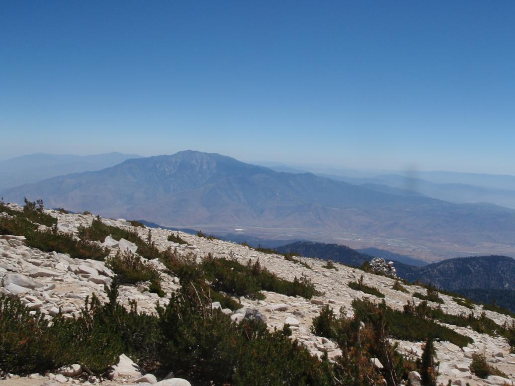
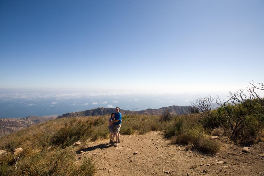
San Jacinto stands tall in the distance as seen from San Gorgonio peak at 11,500 feet last Saturday.
Monday, August 25th, 2008 -
Read more...
 Just got back from a snowshoeing / backpacking trip with my lovely fiance Penelope. We had a great time and got plenty of good exercise. Check out the pictures. We even brought the snow monkey.
Sunday, January 16th, 2005 -
Read more...
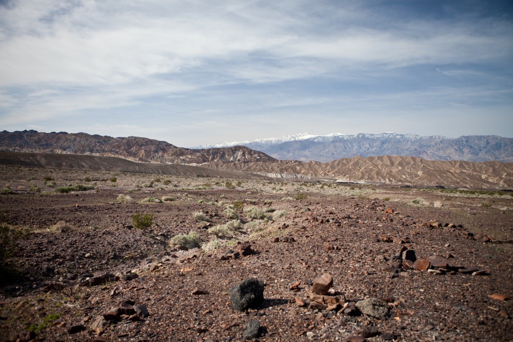
Last weekend my lovely wife Penelope and I took a trip to Death Valley for the Desert Explorers Rendezvous. The Desert Explorers are a group of fun, knowledgeable folks who like to spend time exploring the desert. The exploration frequently involves 4WD vehicles traveling over challenging terrain through beautiful scenery in and around Southern California. I've written about the Desert Explorers before.
This year's Rendezvous took place at the Amargosa Hotel and Opera House. The hotel is located in a unique and historic town, currently with a population of three, called Death Valley Junction.
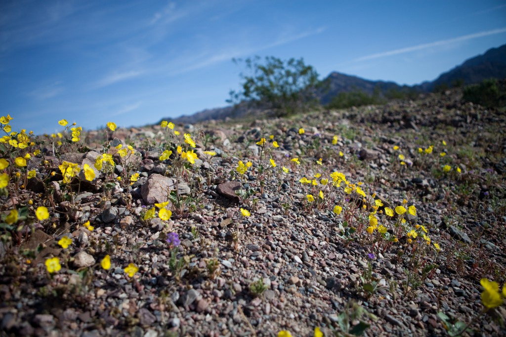
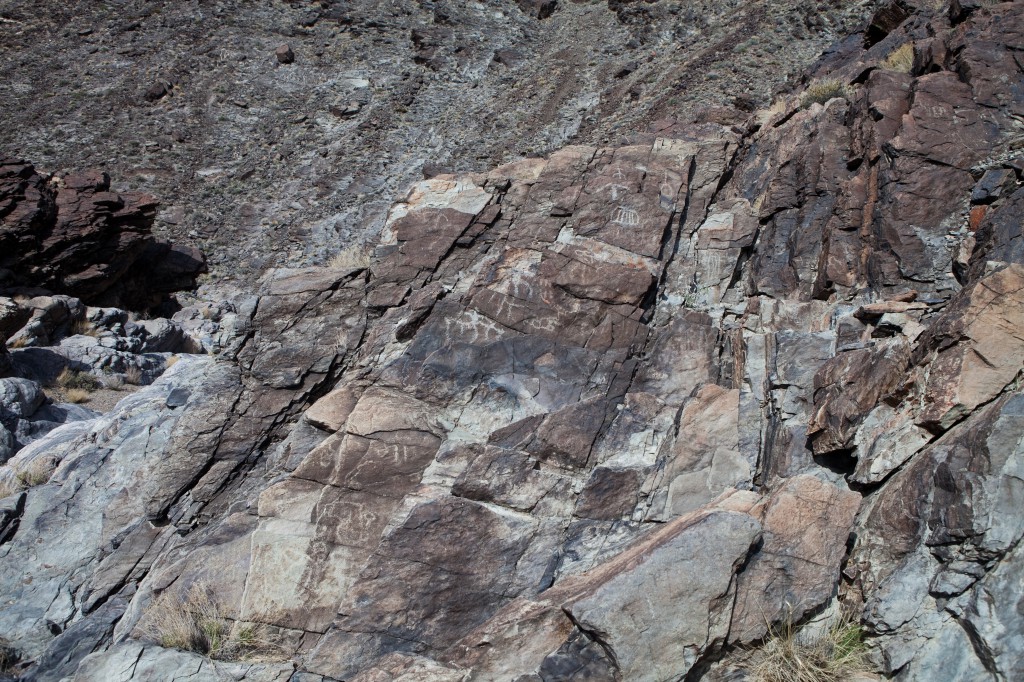
The photos below are from a day trip we took through Death Valley. We hit dirt between Zabriskie Point and Furnace Creek, heading up Echo Canyon road. Along the way we saw wildflowers, petroglyphs and drove up a rock waterfall, a very difficult part of the road. We eventually ended up in the city of Amorgosa, Nevada after traveling roughly 40 miles on a 4WD trail.
Here are some photos from the trip, as you can see the flowers are starting to bloom. I would say this weekend or next would be the perfect time to see them in all their glory:
Wednesday, March 24th, 2010 -
Read more...
On Saturday my lovely wife Penelope and I completed what Backpacker Magazine calls America's 5th Hardest Day Hike. The Cactus to Clouds hike begins in Palm springs at roughly 600 feet above sea-level and tops out at the peak of Mt. San Jacinto at 10,800 feet. The grueling day hike covers over 23 miles, one of which takes you up almost 2,000 vertical feet.
Friday night Penelope and I stayed in Palm Springs at an amazing hotel, which also happens to be #1 in the country on Trip Advisor, called the Desert Riviera. The hotel and its owners are really amazing, and a subject of a future post on this blog. On Saturday morning we woke up at 2:45 a.m. and headed out to the trailhead.
We hit the trail at around 4:00 a.m. with our headlamps blazing. After hiking for 15 minutes the trail petered out and we were left wondering where to go. Penelope became worried that we were never going to find the trail and wanted to go back to the car and try from a different trailhead.
The other trailhead has an even harder-to-find trail so I decided that would be a bad idea. I told Penelope to relax and we backtracked a few hundred yards at which point I saw a white arrow spray-painted on a rock facing uphill. I followed the arrow and we were back on the path to the peak.
After two miles we came to a rock with white writing painted on it which told us to make sure we had plenty of water and that we had 8 miles and 10 hours to go. From what I've read, the actual distance from this point is closer to 10 miles. We hiked on for another hour or so when we saw another headlamp behind us and one ahead of us.
As the sun rose we saw the hiker behind us was a gray-haired woman. She was quickly gaining on us, but she ended up taking a shortcut and was suddenly way ahead of us. We never did catch up to her!
Around 6:30 a.m. the sun began to rise. We had gained a few thousand feet of elevation by that point and the sunrise was beautiful, one of the most enjoyable experiences of the hike.
For the first 9 miles the trail gradually gained altitude, then all of the sudden it basically goes nearly straight up for 3 miles. These miles were difficult and challenging with a steep, loose, rocky trail winding to Grubb's Notch. It was slow-going but we made it to the traverse, which was a welcome change in pace.
After traversing for half a mile we started back up on our final push to the top of the Skyline trail. The last quarter mile was almost straight up, but we were so close we powered up without stopping except to talk to a ranger.
The skyline trail ended up taking us about 8 hours including breaks. We sat down at the ranger station, filled out our permit and ate lunch.
Most people just do the Skyline trail and take the tram down. We decided to do the full Cactus to Clouds and hit the peak. After lunch we powered on up the final 5 and a half miles to the top. As we ascended the temperature dropped and the during the last few miles we were shrouded in clouds.
On our Deer Springs hike to San Jacinto the week before we spent a half hour on the peak and ate lunch. This time we took a few photos, sent out a SPOT message and quickly headed down.
We were very happy to reach the tram station 14 hours after starting our hike in Palm Springs. We felt good that we stuck through it and completed the hike, but boy were we tired. I can't wait for the next (hopefully shorter) hike, maybe it will snow and we'll do some snowshoeing!
If you're up for a serious, grueling, extreme-dayhiking challenge, definitely give the Cactus to Clouds hike a try. Just make sure to bring plenty of water (we brought 1.5 gallons each) and to train for it with at least a 5,000 foot elevation gain hike a few weeks before. Have fun and happy hiking!
Penelope and I stand on the peak of San Jacinto at the apex of our Cactus to Clouds hike.
The sun rises a few hours into our Cactus to Clouds hike.
Coffman's Crag juts out from the mountainside after the hardest part of the Cactus to Clouds hike.
Click here to see the rest of the photos from our Cactus to Clouds hike.
Wednesday, November 5th, 2008 -
Read more...
Last weekend my lovely wife Penelope and I hiked to the top of Gaviota Peak. We have been training for a backpacking trip this coming weekend to the top of Southern California's tallest mountain: San Gorgonio.
Gaviota Peak is located about 20 minutes north of Santa Barbara a few miles in from the coast. The trail is fairly popular, but most people opt to hit the hot springs instead of hiking to the peak. The springs are less than a mile from the trailhead.
We started our hike in the early afternoon and made it to the top in under 2 hours. The trail is an old fire road in mediocre condition. The hike takes your from about 300 feet above sea-level to 2,458 feet.
I decided to bring my camera gear and tripod to shoot some panoramas at the peak. You can see one frame of the panorama below. Unfortunately the sky was quite hazy so you can't see very far. Ideally I would like to do this hike again after a good rain.
The hike was strenuous, but the enjoyable. I look forward to doing it again some time soon. I am excited about our San Gorgonio backpacking trip this weekend.
My wife and I stand on top of Gaviota Peak near Santa Barbara last Sunday after a nice 3 mile hike with over 2000' of elevation gain.
Tuesday, August 19th, 2008 -
Read more...
Three weeks ago, my lovely wife Penelope and I hiked Los Angeles County's tallest peak, Mt. San Antonio, also known as Mt. Baldy. It was a great day hike, with a hefty elevation gain and beautiful views of Southern California.
We started out later than we had originally planned, this was due to me sleeping in. I realized later that I slept in because I was worried about being able to complete the hike.
The route we took was 12 miles round trip, with over 4,000 feet of elevation gain. Those 4,000 fee up occurred in the first four miles of the hike.
We parked at Manker Flats and took the fire road up until we reached the Baldy Bowl trail. The trail cuts almost straight up from the road and is easy to miss, but we had a picture which helped us find it.
We headed up the trail for about two miles when we reached the San Antonio Ski Hut, also known as the Baldy Hut. At the hut we met some cool folks from the San Diego SAR team who fed us fresh baked cookies. After hanging out for a few minutes at the hut we continued on up the Baldy Bowl Trail.
Shortly after leaving the hut we reached some very steep switchbacks. It was tough going, and for the first time I can remember on a hike, Penelope was in no mood to make small talk. After we crested the last switchback she was feeling better and the chatting resumed, thankfully.
A few miles and another couple thousand feet of elevation gain later we were at the top. It took us roughly three hours to get to the summit. We sat down and enjoyed our well-deserved lunch. After eating we hydrated, put on a layer and headed down the Devil's Backbone Trail.
After the first part where the trail got narrow, I said, this isn't so bad, I wonder why people write that it is scary. A few miles later we got to the actual backbone, which was only a few feet wide with steep cliffs on both sides. It's not too bad in the summer, but according to my SAR teammates, it's quite frightening in winter when it's a giant ice-covered cornice of death.
When we made it down to the ski area we contemplated taking the chairlift down, but decided against it and continued down the fire road. The fire road isn't the most visually stimulating area and its long, gradual slope made for a somewhat boring end to the hike.
By the time we got to back to the car we were ready to get home, relax and have some tapas at Ciudad. We were exhausted, but happy that we made it, the whole hike took us just about 6 hours round trip.
Baldy was a great hike and we're looking forward to doing it again soon. I would recommend it to anyone looking for a vigorous day hike.
The sky is clear in the view looking out from the first mile of the Baldy Bowl trail.
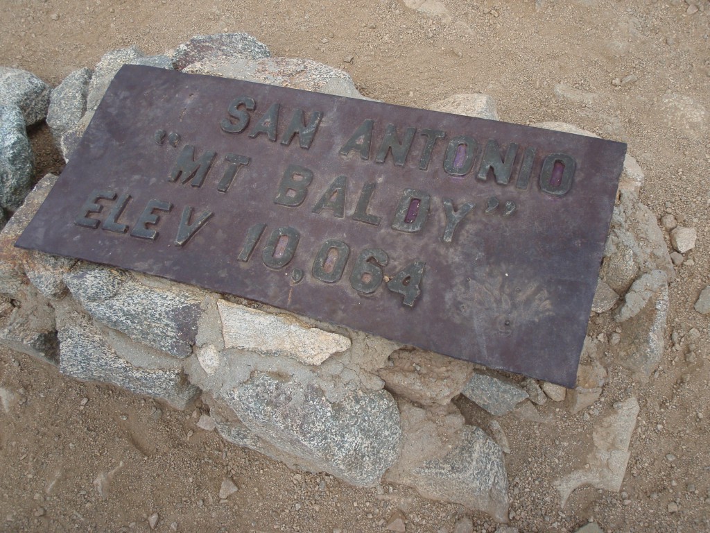
This steel marker sits on the peak of Mt. San Antonio, AKA Mt. Baldy, the tallest peak in Los Angeles County.
Penelope starts down the Devil's Backbone trail after reaching the summit of Mt. Baldy.
Thursday, October 16th, 2008 -
Read more...
Yesterday Penelope and I hiked to the top of Mt. Wilson. It was a tough hike, but well worth the views, plus it's always nice to get a good 6 hour workout!
We started our hike from the trailhead on Mt. Wilson Trail road at roughly 9:30 a.m. The first two miles of the trail was highly trafficked with dozens of day hikers. This part of the trail is also barren thanks to a recent fire and in the morning the sun really beats down on you.
After a mile and a half we passed a fork down to the First Water swimming hole. Once past First Water we hardly saw any other hikers.
3.5 miles into the trip we reached Orchard Camp. This was the halfway point so we stopped and had some snacks and hydrated. We met two mountain bikers at Orchard Camp, they were the only folks on bikes we saw during out hike.
After snacking we headed up to the Winter Creek trail intersection. The last half mile before the intersection was the hardest part of the hike. The trail was narrow and exposed at times and there was little tree cover to shade us.
Once at Winter Creek trail we were excited to only have another 1.7 miles to go and we headed up the half mile and 500 feet of elevation gain of switchbacks to the old Mt. Wilson Toll Road. We followed the old road a half mile and then we took the small trail the final .7 mile up to the peak.
I always let Penelope lead because I tend to walk to fast and tire myself out and she's great at pacing us. For the last leg of the hike she was doing double time and we made it up to the peak quickly.
Once at the top I saw the parking lot and the tourists that drove up and said, "Wait you can drive up here?" Of course I knew there was a road up, but it was still funny at the time. Once at the peak we sat at a picnic bench and ate our lunches before heading down.
Going down the mountain is obviously faster than going up. What took us over three and a half ours to go up took us just over 2 hours to come down. We arrived at the trailhead seven hours after we started out, which includes roughly an hour for our snack and lunch breaks.
So the final stats: 6 hours of hiking time, 14 miles and 4,700 feet of elevation gain. It was a fun hike, although not as visually stimulating as Mt. Baldy. I'm not sure if this will be a repeat hike, but we definitely plan to drive up and do the observatory tour at some point.
San Gorgonio rises above the smog in the distance in this photo taken from the peak of Mt. Wilson on Sunday.
Dave and Penelope stand happily atop Mt. Wilson after hiking to the top in just over 3 hours on Sunday.
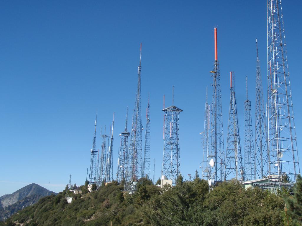
A wide array of antennas cover a hill close to the peak of Mt. Wilson.
You can view more photos from our hike to Mt. Wilson here.
Monday, October 20th, 2008 -
Read more...
This weekend my lovely wife Penelope and I hiked up to the ruins of the White City Resort on Echo Mountain.
The hike is nice and short, a little over five miles round trip. The trail is mostly unshaded and gains about 1,500 feet of elevation on the way up. We didn't get going until around 11:00 a.m. at which time it was quite warm.
Once we made it to the top the hard work was totally worth it. The Mount Lowe Railway was once an amazing railway built to service 3 small resorts. It ended up being plagued by various disasters and shutting down around World War II.
The ruins on top are quite interesting and include foundations, a cistern (see below) and the remains of the cable wheel and part of a train. If you like ruins and deserted places you will enjoy this hike.
We plan on returning, but in cooler weather and heading to the top of Mt. Lowe, which is another 3 miles past White City. If you go on this hike, bring plenty of water!
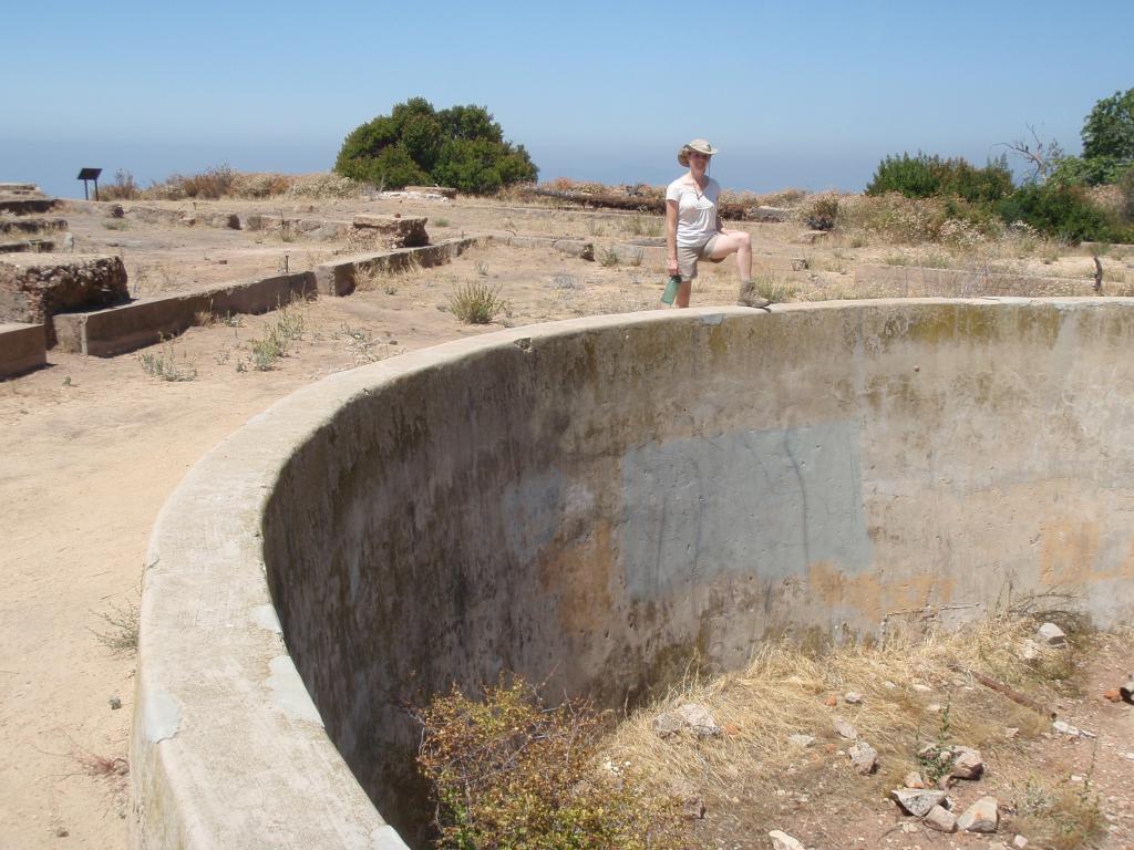
Penelope stands on the edge of the Echo Mountain House's cistern after hiking for a bit over an hour.
Click here to see more photos from our Mt. Lowe / White City hike.
Monday, August 4th, 2008 -
Read more...